Navigating the Ha Giang Loop can be an exhilarating yet challenging experience, especially for first-time travelers. With its winding mountain roads, remote villages, and breathtaking landscapes, having a reliable map is crucial for ensuring a smooth journey. Understanding how to use a map for Ha Giang Loop trip will help you stay on track, avoid unnecessary detours, and make the most of your adventure. Whether you rely on a digital app or a printed map, this guide will provide essential tips for navigating the loop efficiently.
Contents
- 1 Choosing the right map for Ha Giang Loop
- 2 Understanding key landmarks and routes on the map
- 3 Using GPS and offline maps for accurate navigation
- 4 Marking fuel stations and rest stops on your map
- 5 Avoiding common navigation mistakes
- 6 Adjusting your route based on weather conditions
- 7 Final tips for successful navigation
Choosing the right map for Ha Giang Loop
Before setting off on your journey, selecting the right map is essential. While Google Maps is a useful tool, it may not always be accurate in remote areas. Many travelers prefer using offline navigation apps like Maps.me, which provides more detailed road information and allows you to download maps in advance. Additionally, many Ha Giang motorcycle rental shops provide printed maps highlighting key stops, fuel stations, and viewpoints. Carrying both a digital and a physical map ensures that you have a backup in case of technical issues or a lack of mobile signal.
Choose the perfect map for easy Ha Giang Loop navigation
Understanding key landmarks and routes on the map
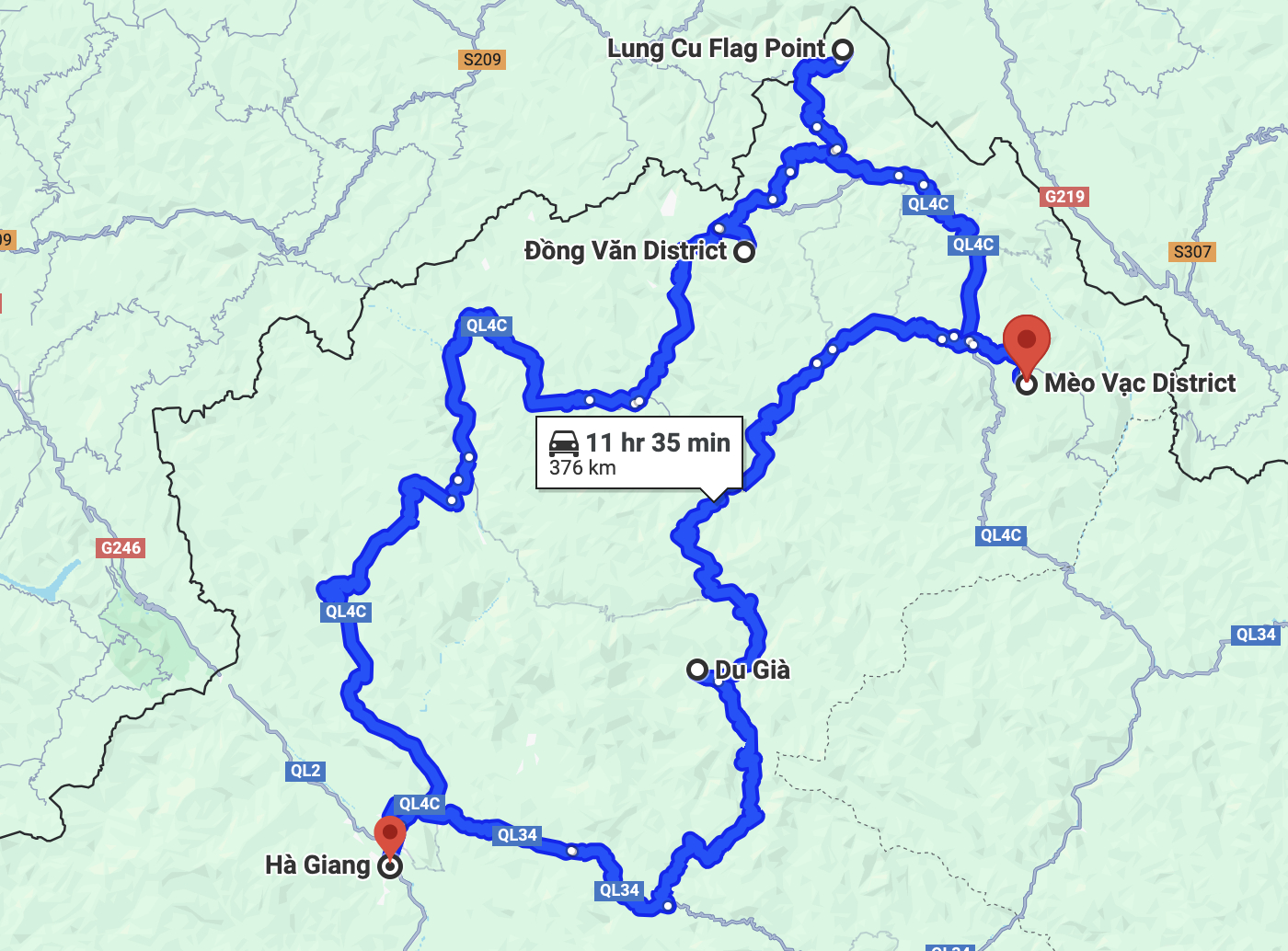
Familiarizing yourself with the main stops and routes before starting the loop will help prevent confusion during the trip. Key locations to identify on your map include Ha Giang city (the starting point), Quan Ba, Yen Minh, Dong Van, Meo Vac, Du Gia, and back to Ha Giang. The loop covers approximately 350 kilometers, and knowing the distances between these towns will help you plan daily rides more effectively. Using a map Ha Giang Loop travelers recommend can also reveal hidden gems, such as lesser-known villages or scenic detours.
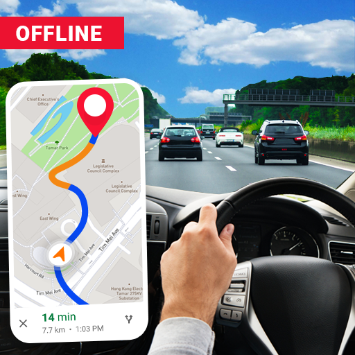
While riding through the Ha Giang Loop, GPS-based apps like Maps.me and Google Maps can be helpful, but they should not be solely relied upon. Some roads may not be accurately marked, and incorrect directions could lead to unnecessary detours. Downloading an offline version of the map Ha Giang Loop riders use most frequently is highly recommended. To ensure accuracy, cross-check GPS directions with road signs and local advice. If unsure about a turn, stopping to ask locals or fellow travelers can be a lifesaver.
Use GPS and offline maps for precise and reliable navigation
Marking fuel stations and rest stops on your map
Fuel stations are limited in some parts of the Ha Giang Loop, so marking them on your map before you start riding is crucial. Major towns such as Ha Giang, Yen Minh, Dong Van, and Meo Vac have reliable fuel stations, but in more remote areas, options can be scarce. Having a clear idea of where to refuel will prevent any unexpected difficulties on the road. Additionally, identifying potential rest stops, including cafes, homestays, and scenic viewpoints, will help you pace your journey and make necessary stops for breaks or meals.
One of the most common mistakes travelers make is blindly following GPS directions without considering road conditions. Some smaller roads or shortcuts suggested by apps may be in poor condition, leading to unnecessary challenges. Checking recent traveler reviews or asking for advice from Ha Giang motorcycle rental shops before departure can help you avoid difficult paths. Another mistake is underestimating travel times—while distances may seem short, the winding and mountainous roads can significantly extend riding durations.
![]()
Use GPS wisely to avoid common navigation mistakes
Adjusting your route based on weather conditions
Weather plays a crucial role in navigating the Ha Giang Loop. Heavy rain can make certain roads slippery and dangerous, requiring adjustments to your planned route. Before setting out each day, checking the weather forecast and consulting locals can help you determine the safest paths. If conditions become unsafe, being flexible and choosing an alternative route may be necessary. Having a map that allows you to identify backup routes will make it easier to adapt to changing circumstances.
To ensure a smooth Ha Giang Loop motorbike experience, always plan ahead by studying your map and marking key points of interest. Carrying a power bank for your phone and keeping a printed map as a backup will prevent navigation issues. Riding in a group or teaming up with other travelers can also enhance safety and make navigation easier. By understanding how to use a map for Ha Giang Loop trip effectively, you’ll have a safer and more enjoyable adventure, making the most of Vietnam’s most scenic motorbike journey.